BraveCL
How to create a historical map study plate on Mac
Compare historical map sources, compose a study plate with contextual photos, and set a custom print size in Old World Maps Collection.
- What you'll achieve
- A 12-by-8-inch study-plate composition with the Hereford map at left and three supporting photographs at right.
- What you need
- Old World Maps Collection for macOS, version 3.0 or a version with equivalent controls.
- Three supporting photographs you have permission to use: historic architectural decoration, a map-detail close-up, and an astrolabe or similar object.

Old World Maps Collection lets you compare cataloged historical maps before selecting one for a composition. This guide uses the Hereford Map 1896 facsimile, adds three contextual photographs, and arranges a study plate. Each step is pictured from the Mac app.
1.Open the map research workspace
Switch to the Research workspace. Browse the map source list and the empty A/B comparison area. You can search the 80 available source records before choosing a map.

Research view in Old World Maps with the map source browser, empty comparison area and A/B slots. 2.Pin the Hereford map in slot A
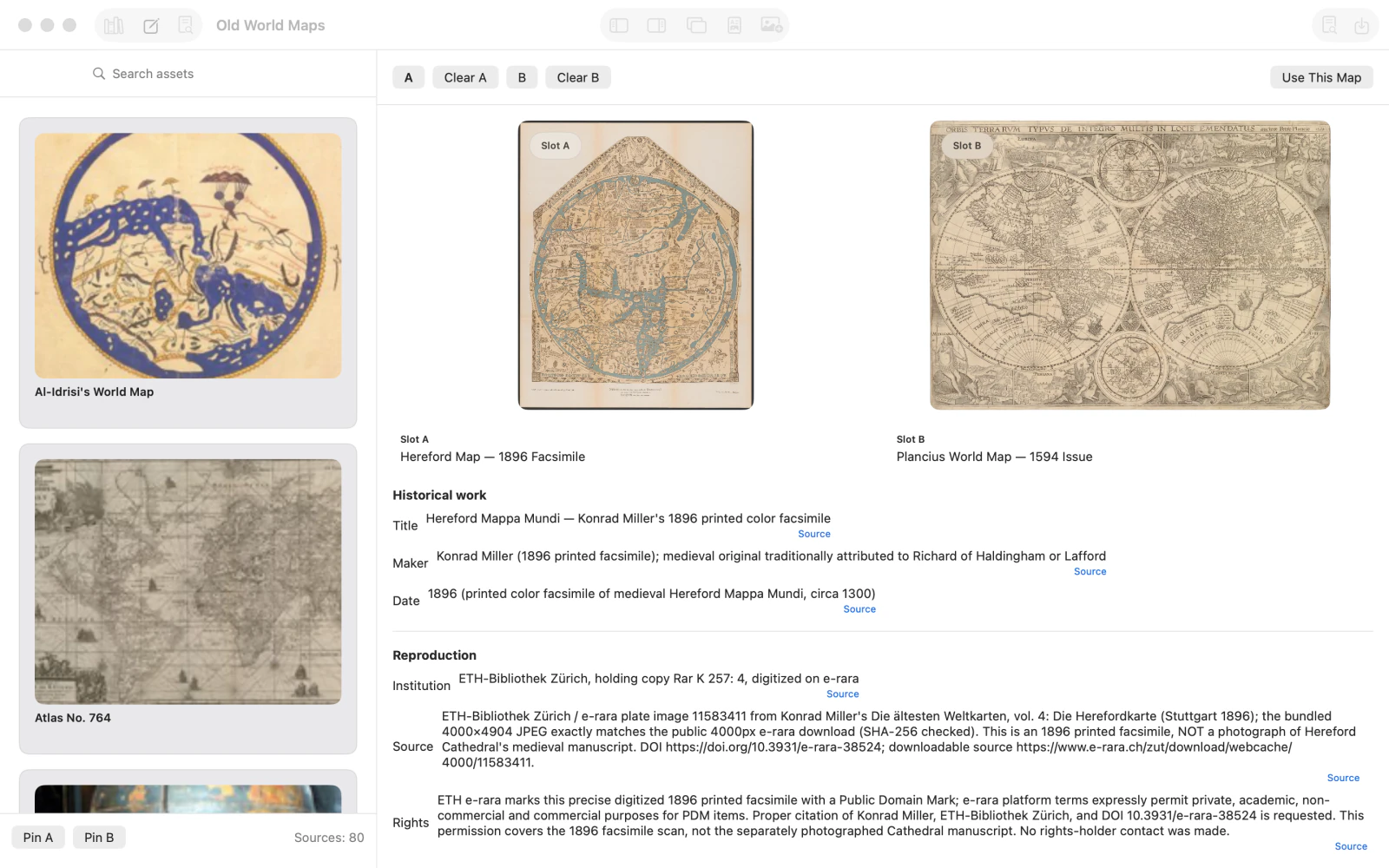
Select Hereford Map — 1896 Facsimile from the source browser and choose Pin A. Review its catalog title, historical attribution, reproduction institution, date, and rights information.

Hereford Map 1896 facsimile pinned in source slot A, with maker, dating and reproduction notes below. 3.Compare a Plancius map in slot B
Select Plancius World Map — 1594 Issue, then choose Pin B. The two map images now appear side by side for comparison.
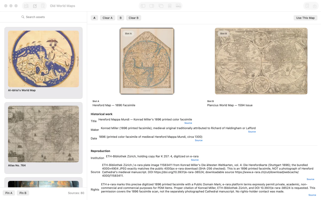
Hereford facsimile and Plancius 1594 world map compared side by side in slots A and B. 4.Use the Hereford map on the canvas
With the Hereford map selected in slot A, click Use This Map. Switch to Compose if needed. The map becomes the composition background with no photo layers yet.

Hereford facsimile displayed on the composition canvas with an empty Layers panel. 5.Import an architectural detail photo
Import a photograph showing historic architectural decoration as a new image layer. Select it and use the Transform inspector to position it over the map.

Architectural decoration photograph selected over the Hereford map with Transform controls visible. 6.Position a map-detail photograph
Import a second photograph showing a close-up of historical map artwork. Position it separately on the canvas, adjusting its X and Y coordinates using Transform.

Two contextual photo layers placed in separate parts of the Hereford map canvas. 7.Add the astrolabe photograph
Import a third photograph of a historic astrolabe. Use Scale and position adjustments to make it a smaller supporting layer for the study plate.

Third small astrolabe photograph added on the map alongside architectural and map-detail photos. 8.Open the Study Plate layout
Choose Study Plate in the command surface. The canvas now previews a structured layout with the map and three contextual photos. The Output inspector exposes output targeting.

Study Plate output preview with the map at left and three stacked contextual photographs at right. 9.Set a custom 12 × 8-inch output
In Output, choose Custom and Physical Size. Enter 12 inches wide, 8 inches high, and 200 pixels per inch. The target becomes 2400 × 1600 pixels; upscaling does not create new source detail.

Custom Physical Size target set to 12 by 8 inches at 200 pixels per inch, targeting 2400 by 1600 pixels. 10.Preview Photos Beside
Click Commit Target, then Generate Arrangements. In Arrangement Audition, choose Photos Beside to compare an arrangement that keeps the map and supporting photographs alongside each other.

Arrangement Audition showing the Photos Beside option and alternate composition previews. 11.Apply the final study-plate arrangement
Click Apply for the preferred candidate. Inspect the complete Hereford map at left and the three supporting photographs grouped to the right. Export separately if you need a finished image file.

Finished historical study plate with the complete Hereford map at left and three contextual photographs at right.




After the last step
The output target is 2400 × 1600 pixels at 200 pixels per inch. The guide ends at the completed composition, not at a saved or exported file.
Tips
Read the map record's original-work attribution and reproduction metadata before quoting dates or origins.
Comparison slots A and B are for research; Use This Map selects a background for the composition.
Use Transform to arrange imported photos. Exact layer coordinates depend on the chosen images.
The requested print density defines target dimensions; it cannot restore detail absent from a source scan.
Watch outThe chosen Hereford image is an 1896 printed facsimile of a medieval map, not a photograph of the original artifact.
Watch outMap reproductions and imported photographs can carry separate usage restrictions; check source records and permissions before distribution.
Watch outThe pictured final arrangement is a composition, not proof of an exported image. Save or export separately, and expect flattened output rather than editable layers.